


f the project is a human body, the project manager is the mind,” says Matt Gutacker, managing principal of Alaska Remote Imaging (ARI), offering an analogy for what his company provides. “In order for the mind to be healthy, it has to be receiving and disseminating information to all other parts of the body.”
Gathering that information is what Anchorage-based ARI does with cutting edge technologies that allow the company to collect vital information about job sites—information that could take days or even weeks to amass for a crew lacking access to the tools Gutacker and his associates have at their fingertips.
“There’s new technology that trades and engineers and architects can utilize,” he says. “But it’s moving so fast, who’s gonna pay attention to it?”
Then ARI furnishes its clients with data they can interact with in order to finalize crucial planning.
“We turn real things into digital things,” Gutacker says. “With an emphasis on serving construction and anything that requires geospatial data.”
To this he adds, “We do the what and the where. We don’t do the how.”
With the interactive data they provide, ARI can help architects decide where to place windows and doors, assist developers in determining the best site for a structure on a piece of property, or offer telecom companies accurate modeling of existing towers, showing precisely where pieces of equipment are placed.
“As the world increasingly is working digitally and as design is increasingly done in 3D,” Gutacker says,” the demand for geo-referenced, to-scale 3D modeling is rising.”
“Self-teaching is a part of that experience,” he explains.
After high school, he rode a bicycle across the country, passing through mountains, prairies, and other landscapes he’d never seen before. The following year he took a self-supported ride across 700 miles of Alaska. Along the way he says he realized, “I didn’t want to raise my family one day in New Jersey.”
After marriage, he and his wife decided to place their bets on Alaska. Gutacker found a job with a construction company and quickly worked his way up from apprentice to project manager. Near the end of his seven years there, “I started using 3D scanning to document my construction sites.” This is where the seed for ARI was planted.
Seeing the profound impact these tools had on his projects, Gutacker started running ARI out of his garage in 2021. Initially he ran the company full time while remaining with the construction firm, but success came quickly and the company grew rapidly. ARI served 420 projects for 70 organizations in 170 different Alaskan communities last year alone.
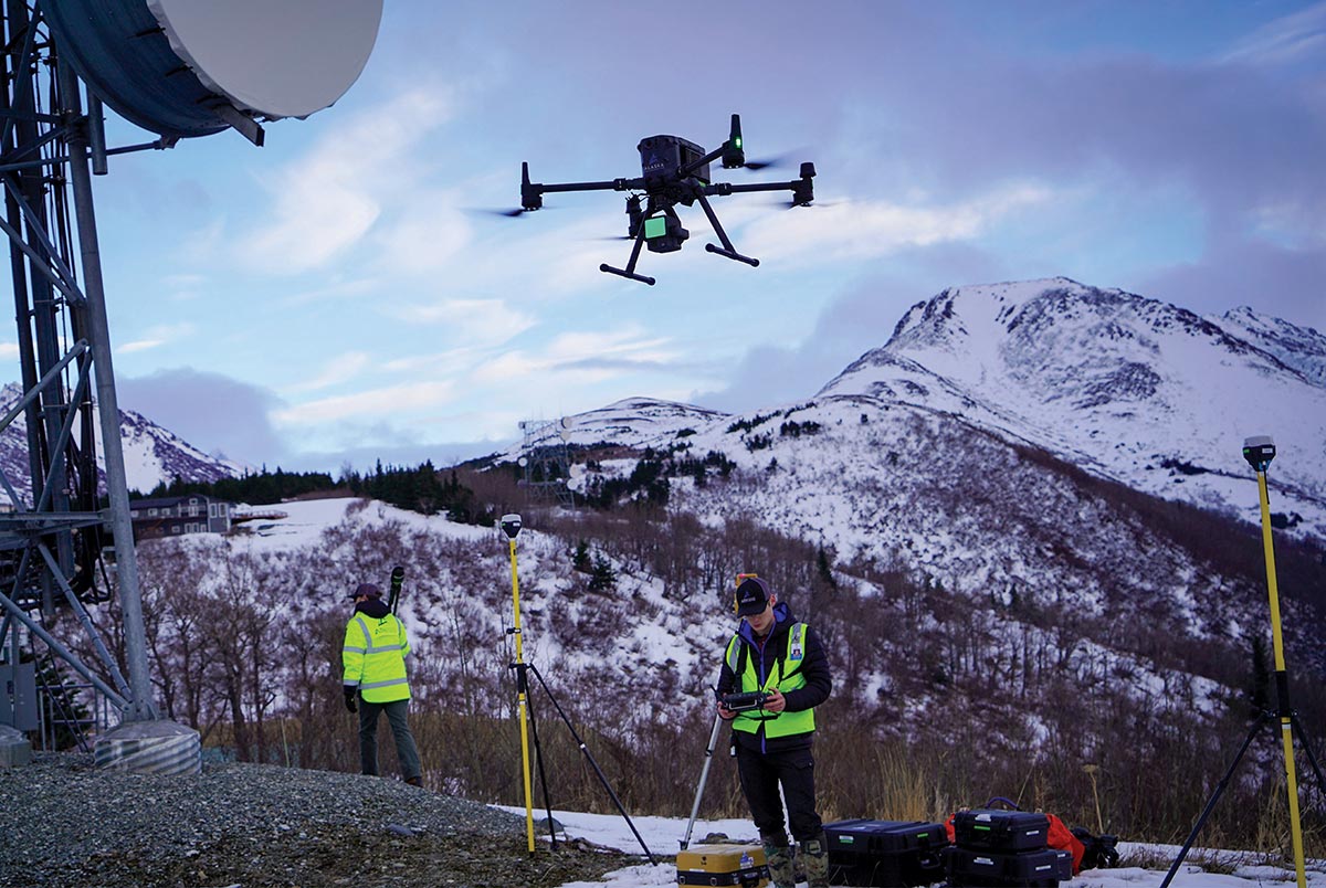


As land survey firm, ARI often finds itself in the balance between the modern and the traditional. Conventional land survey is a trade within itself, and in many ways new technology has a more limited impact on what it means to be a surveyor that one might think. Finding, testing, and standardizing this balance requires a lot of attention and review from seasoned experts.
“If you’re a construction company, you might go out and buy a 3D scanner because you need one for a specific task,” Gutacker explains. “But if you want to have a whole suite of options and hardware and software to solve your problems, you can call up ARI. We have a whole staff dedicated in the field, in post-production, and we have access to more tools.”
Alaska Remote Imaging

Like any tool, there’s a learning curve in becoming adept at using imaging equipment and software. Having a partner with the tools and the knowledge base required to use those tools effectively can be an asset. That’s where ARI shines.
“We can buy more toys and dabble in more software. We have more depth on the bench than most companies would care to self-perform with,” Gutacker says. “We’re where the technology meets the job site.”